 | |||
|
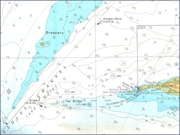
Chart illustrating the underwater landscape corresponding to the view in the previous photograph. Notice the shallow water of The Bridge with the Yellow Black Yellow west cardinal buoy marking its far end. Just beyond that is the red pillar buoy marking the south-western and of the Shingles, shown in dark blue. Depths are shown in metres and decimetres above chart datum, approximating to the level of low spring tides | |||
 | |||
| |||
| Taken from Admiralty Chart SC2219 : Western Approaches to the Solent, 1994 edition | |||
| |||

|

| ||
| |||